 From the kitchen table, I caught a glimpse of a FedEx truck driving away. Yikes—maybe they’re here! Sure enough, the first 40 copies of Tahoma and Its People were on the front doorstep. I had arranged for family and a few friends to gather for a “book reveal,” but the books had come sooner than expected—the party wasn’t until tomorrow. I felt like a nine-year old on Christmas Eve, with the gifts already under the tree, but having to wait until Christmas morning.
Christmas came at last (in February, this time), and Valerie, our oldest offspring Dimi and a handful of close friends circled up for the box opening/book reveal. Drum roll please! It was a “moist” and memorable moment that took “only” ten years and eight rejections between the original idea to holding the book in my hand. Some readers might recall that I began the project only after being unable to find a current Mount Rainier natural history to read with my Evergreen students, followed by relentless pestering from some of my colleagues. I’ve found the book I was searching for, and I hope you’ll be glad to find it, too.
Tahoma won’t actually be  released until early March, after it clears distribution channels and makes its way onto bookstore and warehouse shelves. Libraries stock it a bit later, after acquisition and processing. For now, books are available at jeffantonelis-lapp.com—thanks to Tech Wizard Bill Gesler, at WSU Press, and available for preorders at Amazon.
Someone asked, “What will you do now with all this free time on your hands?” Actually, I’m as busy as ever: networking and arranging presentations—see the events tab on the website. Creating the presentation to support the book, using lots of great images. Figuring out how to run a small tiny business. So much free time!
I’ll close the March blog with one mountain story for the road—literally. In the last few years of fieldwork, our friend Robb Pack tagged along many times. A handful of times each July, for example, we’d get up at 2 a.m. to sleep-stagger up the Carbon River road to listen for nesting marbled murrelets. These Nerf football-sized seabirds fly hundreds of miles a day to nest and feed their young high atop Douglas firs in old growth forests. (Read more about them in the Carbon River chapter.) We slogged all over the Puyallup River tideflats and downtown Tacoma, looking for the sites that made Commencement Bay a Superfund site and for ancestral Puyallup village locations. (See the Puyallup River chapter for details).
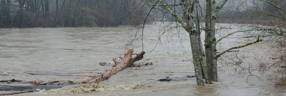
Robb and I are also big fans of high water, often heading up to the Carbon after the heavy rains brought on by atmospheric river events (Find them in the Longmire chapter.) After an especially soggy, record-breaking January that saw rain on every day except New Years, we figured it was prime time to see if the Carbon had filled its floodplain and was floating giant root wads downstream.
On a whim that morning, I texted park geologist Scott Beason that I’d be driving up to see the Carbon flood show. He texted me immediately, “Okay, but be careful. There’s an extreme landslide hazard up there.” Intuition told me to go to Plan B, so Robb and I decided to check out the White and Puyallup River confluence near Sumner instead. We weren’t disappointed.

After I made it home, I dried out and settled in with an afternoon coffee to check the flood and landslide conditions. A slide near Sunshine Point just inside the park’s Nisqually Entrance had damaged the road. A major slide on Highway 706 east of Ashford had closed both the road and the park, with a reopening not expected until mid-March. But most of all, imagine my surprise to learn that a major slide had blocked the Carbon River road that morning. Had we not heeded Scott’s warning, who knows what might have happened? Let’s hear it one more time for listening to one’s intuition when it comes to the mountain and wild conditions. We missed the Carbon’s flood stage, but we lived to play another day—thank goodness!


